Geological Survey Update
On June 29, 2022, a geological survey of the proposed skatepark was performed with the help of HOH local and geologist-extraordinaire, Patrick Diggins. The proposed site on the Burke Estate comprises shallow bedrock (a unit called the Fordham Gneiss) overlain by approximately 3 feet of sandy soil. The depth to bedrock varied across the area from less than two feet to as much as five feet thick. On average, we have about 3 feet of excavation until reaching bedrock.
What does this mean? Well, it poses a challenge to the design of the park, especially with regards to carving out a deep bowl for skaters. Luckily, the pro's at 5th Pocket Skateparks have this information and will use the natural grade of the hill to design and construct a park that takes the natural landscape into consideration.
Coming soon.... the proposed DESIGN!!!

Geological survey of the Burke Estate site for the skatepark
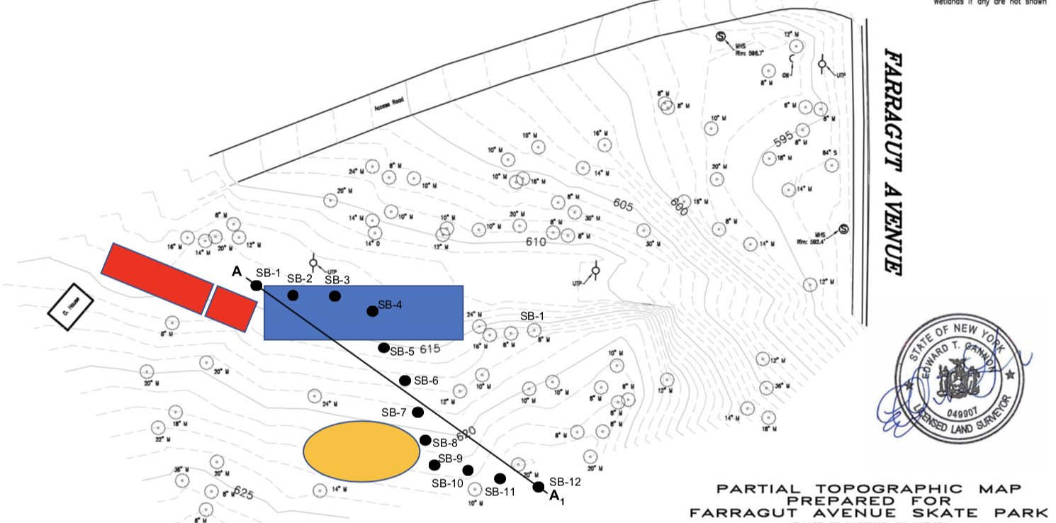
Partial survey of the Burke Estate with the access road and Farragut Ave as landmarks. The red rectangles denote the entrance path to the park from the access road (near the bathrooms); the blue region denotes the flat, street section. The yellow oval denotes the bowl.
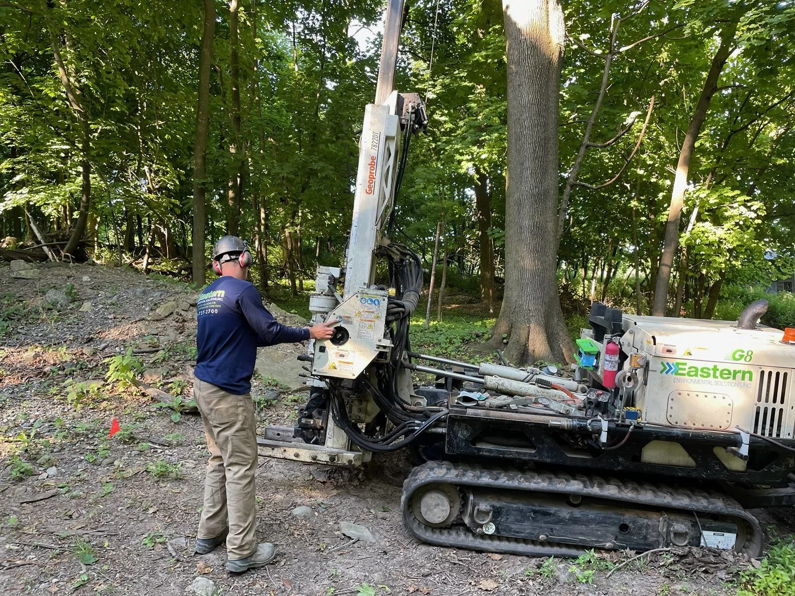
Workers working and machines machining on June 29, 2022! This machine was used to make boring holes to determine the information in the geological survey.